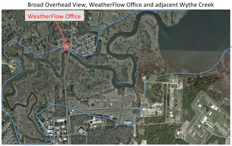
Poquoson, VA – WeatherFlow recently unveiled its newest observing capability – a water level sensor. WeatherFlow is testing a low-cost, low-power, high accuracy instrument that senses water level. The testing ground is at Wythe Creek, an offshoot of the Back River that flows adjacent to the WeatherFlow office in Poquoson, Virginia. The bridge over the creek provides an excellent location for the instrument and early returns on the observations look encouraging. WeatherFlow staff will continue to monitor the output and hope to associate variability in retrieved levels to one or more contributing factors such as prolonged onshore flow or intense precipitation from summertime convection. This observing capability will provide valuable information to coastal communities, ranging from a simple knowledge of current water levels to analyzing and understanding long-term water level anomalies that may be associated with climate change. For more information about this new water level sensor or any of the rest of WeatherFlow’s coastal observing platform contact Jay Titlow.