
Poquoson, VA – WeatherFlow, in collaboration with the Virginia Tech Advanced Research Institute, is studying how to improve computer forecast model performance at wind turbine heights. The project seeks to develop a wind monitoring and forecasting system for offshore wind energy, particularly across the coastal Mid-Atlantic region. In order to collect wind speed and directional data at higher altitudes WeatherFlow has partnered with Axys Technologies to deploy a Vindicator III LiDAR WindSentinel Land Station. 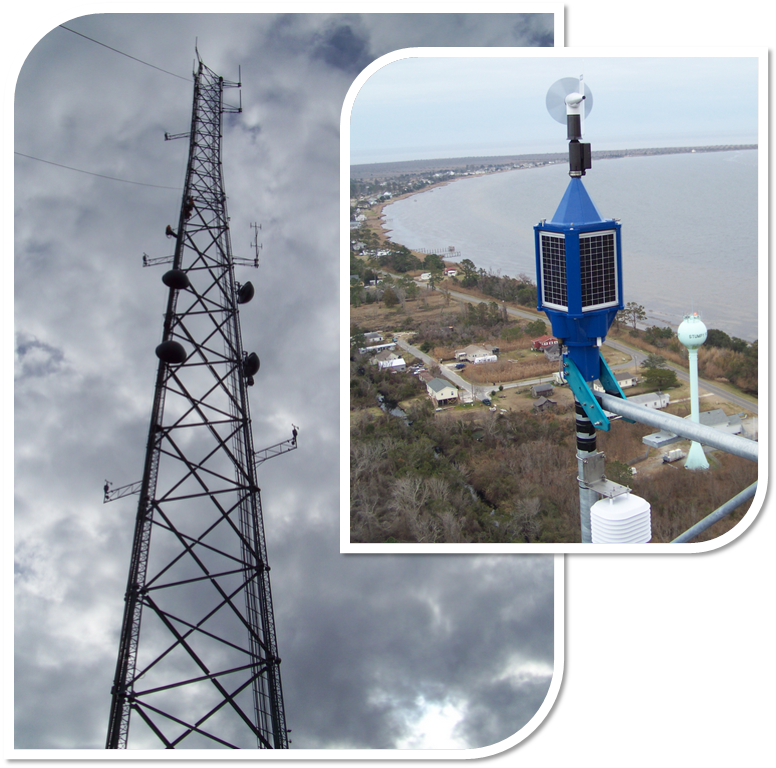 The LiDAR, which is a remote sensing technology that takes measurements utilizing a laser and then analyzing the reflected light, was deployed for a field-verification period next to a tall met tower at Stumpy Point, N.C. (pictured ) After the three month field-verification, the LiDAR (pictured below ) was redeployed on a small island that forms part of the Chesapeake Bay Bridge Tunnel system. For a period of up to one year the LiDAR will continue to collect data in order to validate and improve WeatherFlow’s wind forecasting models.
According to analyses by the Virginia Coastal Energy Research Consortium, the estimates of the wind resource off Virginia’s shoreline may have an error of 25% or more. This level of uncertainty serves as a deterrent to investment in offshore wind development. In an effort to help stir economic growth in this emerging market, the Commonwealth Research Commercialization Fund (CRCF) has funded this wind profiling project. 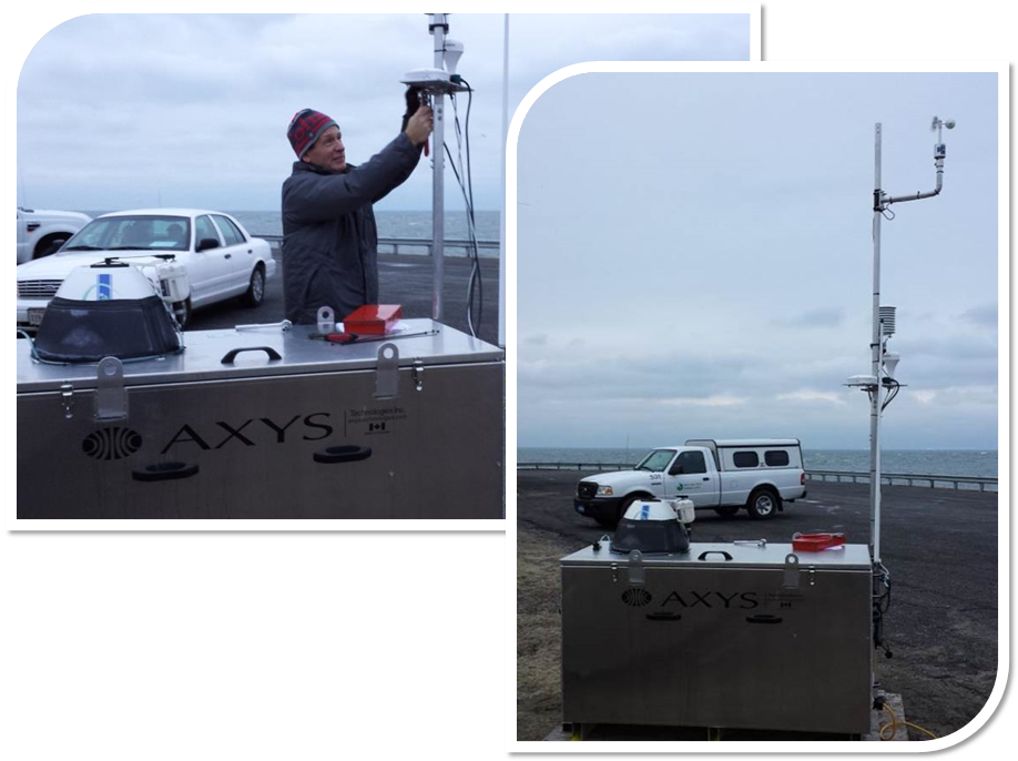 According to WeatherFlow’s Director of Business Development, Steve Woll, “With no measurements currently available in the coastal zone at wind turbine rotor heights, we’re looking forward to using WindSentinel’s data to better capture the highly variable features of the coastal wind regime. That understanding will help us improve our forecast model and better characterize the winds at the offshore wind energy areas.”