
Microburst Research uses WeatherFlow Data
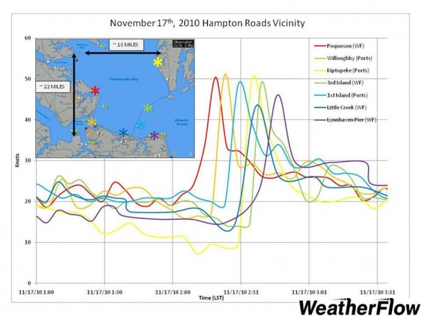
December 21, 2010. Suitland, Maryland. NOAA/NESDIS researcher Dr. Ken Pryor is using Weatherflow observations to help verify his newly developed microburst forecasting technique, in which he uses GOES Satellite imagery to estimate surface wind speeds emanating from convection. On several recent occasions, WeatherFlow observations have verified the estimates generated by his algorithm. Two such events occurred on […]
Microburst Research uses WeatherFlow Data Read More »